


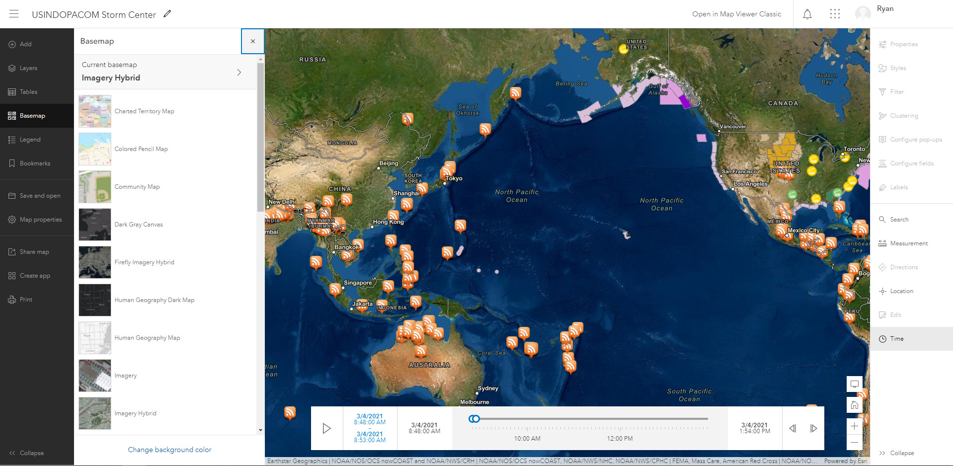
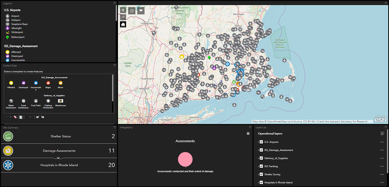
Maps
Visually collaborate with your group by geotagging content and creating custom, interactive maps. With Portal for ArcGIS on APAN, you can geographically represent information in order to provide acute awareness to your audience. Portal for ArcGIS supports importing and exporting of GIS content and is intuitive to support a wide user base.
Create
- Build various maps for your group, each with a unique subject matter, region, or focus
- Use feature tools to add points, draw lines, and create defined shapes
- Customize your map by changing a feature’s style and color
- Provide geographic awareness to your community by geotagging blogs, wikis, forums, and files
- Enable map editing for group managers to allow collaboration on geospatial information sharing
Share
- Import KML, JSON, SHP, CSV or connect to existing REST services within other Portals to display other geographic data files into maps to share with your community
- Save public geo-feed URLs to bring real-time and updated geographic content to your group member’s attention
- Export custom created map features as a SHP, CSV, Excel, FGDB, GeoJSON or Feature Collection file type to share and utilize outside of APAN

Explore
- Immerse into geographic regions with ArcGIS Portal applications with enhanced functionality templates within Web Appbuilder and other widely available Esri mobile apps
- Change between basemaps to explore and provide detailed analysis of your map data such as heat maps, Counts and Amounts by size or color and many more
- Enhance physical attributes of a location and layer through numerous icons that are available within the Portal, or use your own custom icons to show relevant information to plan for exercises and respond to events